Floor Plans
Floor plans are images of a site's levels, over which zones are drawn as polygons for visualization in the Zone Map.
Floors
Each site can have multiple floors (levels). Floors are organized by level:
| Level | Format | Example |
|---|---|---|
| Negative | B1, B2, B3... | Basement, garage |
| 0 | GF | Ground floor |
| Positive | 1F, 2F, 3F... | Upper floors |
A floor can be marked as default — it is displayed first when opening the map.
Floor list
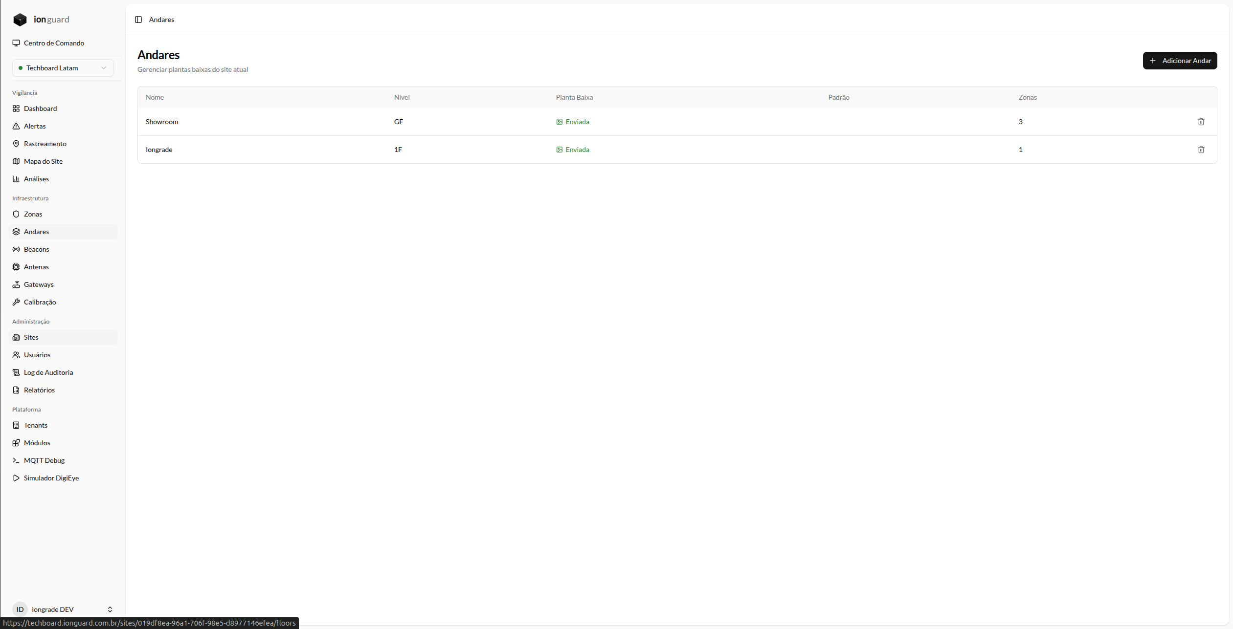
The Floors page (/sites/{site}/floors) displays:
- Name — Floor name
- Level — Formatted as above
- Floor plan — Upload indicator (with icon)
- Default — Badge if it is the default floor
- Zones — Number of associated zones
Create a floor
- Go to the site page and click "Floors"
- Click "Add Floor"
- Fill out the form:
| Field | Required | Description |
|---|---|---|
| Name | Yes | Floor name (e.g., "Ground Floor", "2nd Floor"). Max. 255 characters |
| Level | Yes | Integer (-10 to 200). Negative for basements, 0 for ground floor |
| Floor Plan | No | Floor image. Formats: PNG, JPG, SVG, WebP. Max. 10 MB |
| Default floor | No | Mark as the floor displayed by default on the map |
- Click "Save"
For best quality on the map, use PNG or SVG images with a transparent or white background. The recommended resolution is at least 2000px wide.
Zone boundary editor
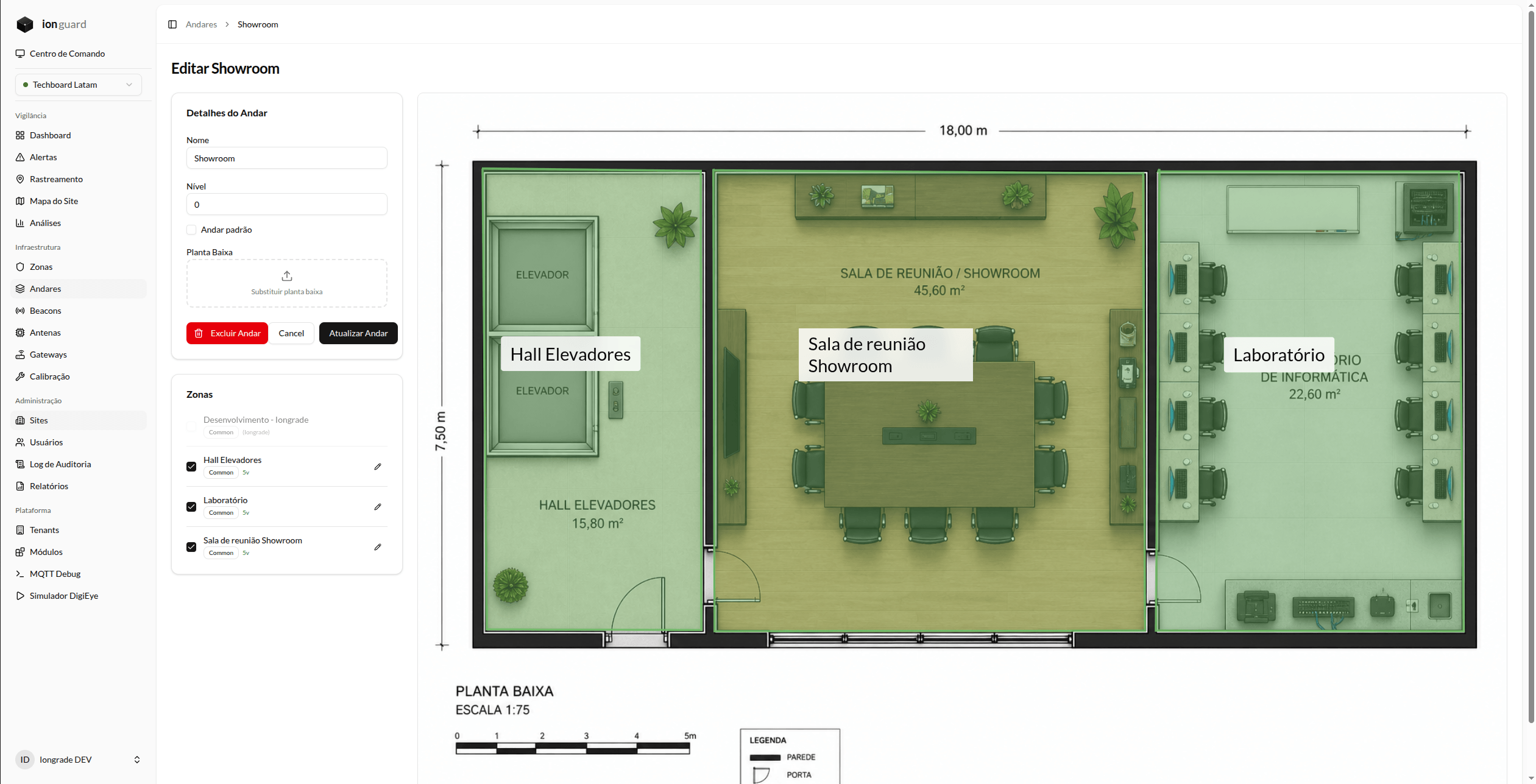
After uploading the floor plan, the boundary editor allows you to draw the zone polygons over the image:
How it works
- Edit the floor
- In the "Zones" section, the available zones (not associated with another floor) are listed
- Click "Assign Zone" to associate a zone with the floor
- Click "Edit Boundary" to draw the zone polygon over the floor plan
- Adjust the zone color for visual differentiation
- Set the display order (zones with a lower order are rendered below)
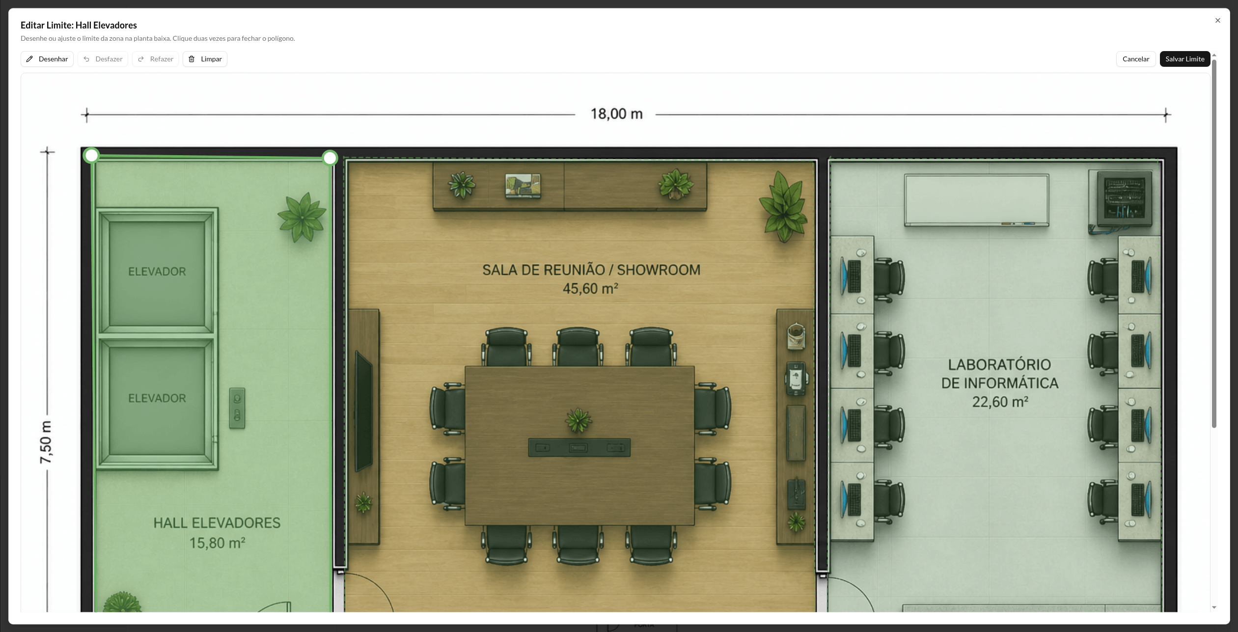
Editor tips
- Click on the vertices to adjust the polygon
- Use precise coordinates to align with walls and corridors
- Zones can overlap (use the order to control which one is visible)
- Each zone's color is independent of its type — allowing visual customization
Edit a floor
In the list, click the floor name. You can change the name, level, floor plan image, and default status.
Delete a floor
Click "Delete" in the list. The dialog shows how many zones are associated with the floor. Zones are dissociated (not deleted).